GPS - GARMIN - GPSMAP® 65S
Need help ?
Need help ?
Our experts are at your disposal for advice and purchase assistance.
Call us at: 3481120522
Write to us at: info@wildgear.it
Frequent questions
Frequent questions
Do you have any questions about managing your order?
We have prepared an explanatory FAQ to help you, click here to consult it
Cash on delivery
Cash on delivery
We offer the cash on delivery service only on Italian territory. We are sorry
Delivery and shipping
Delivery and shipping
We are committed to processing orders as quickly as possible, usually our packages arrive at the final address within 48 hours. If an item is accidentally unavailable, you will be contacted as soon as possible.
Frequent questions
Frequent questions
Do you have any questions about managing your order?
We have prepared an explanatory FAQ to help you, click here to consult it
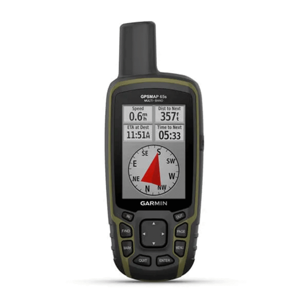
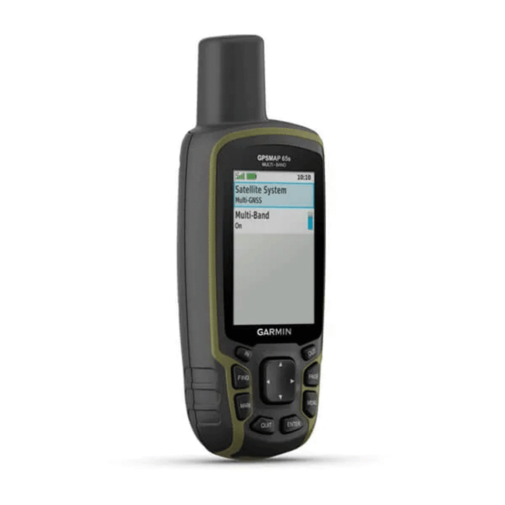
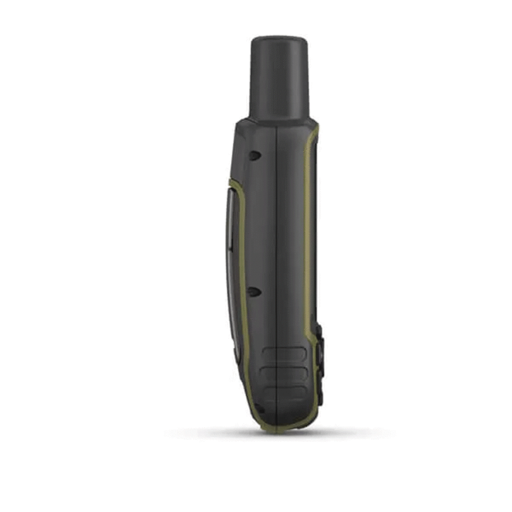
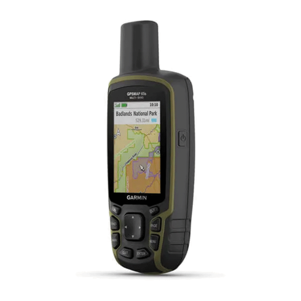
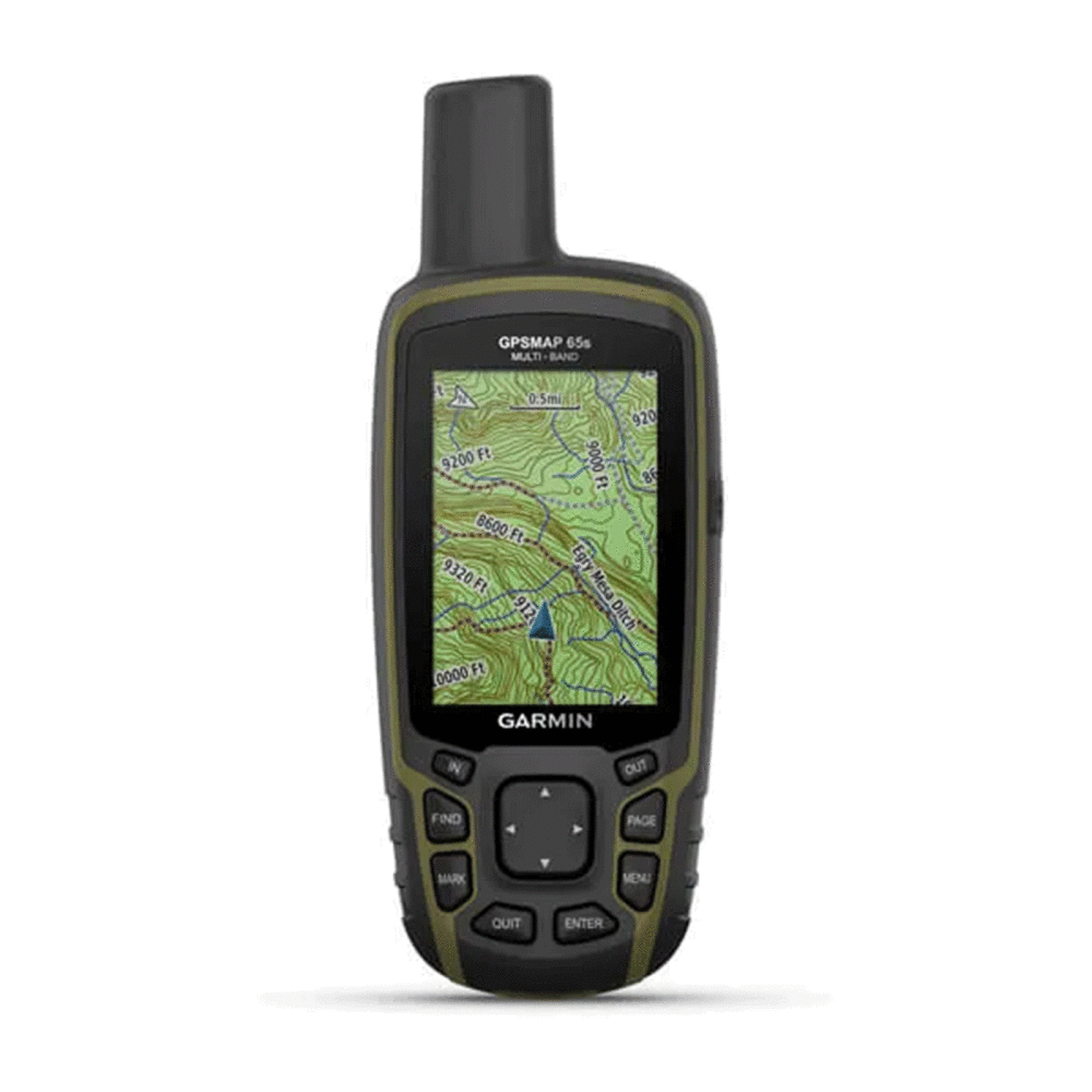
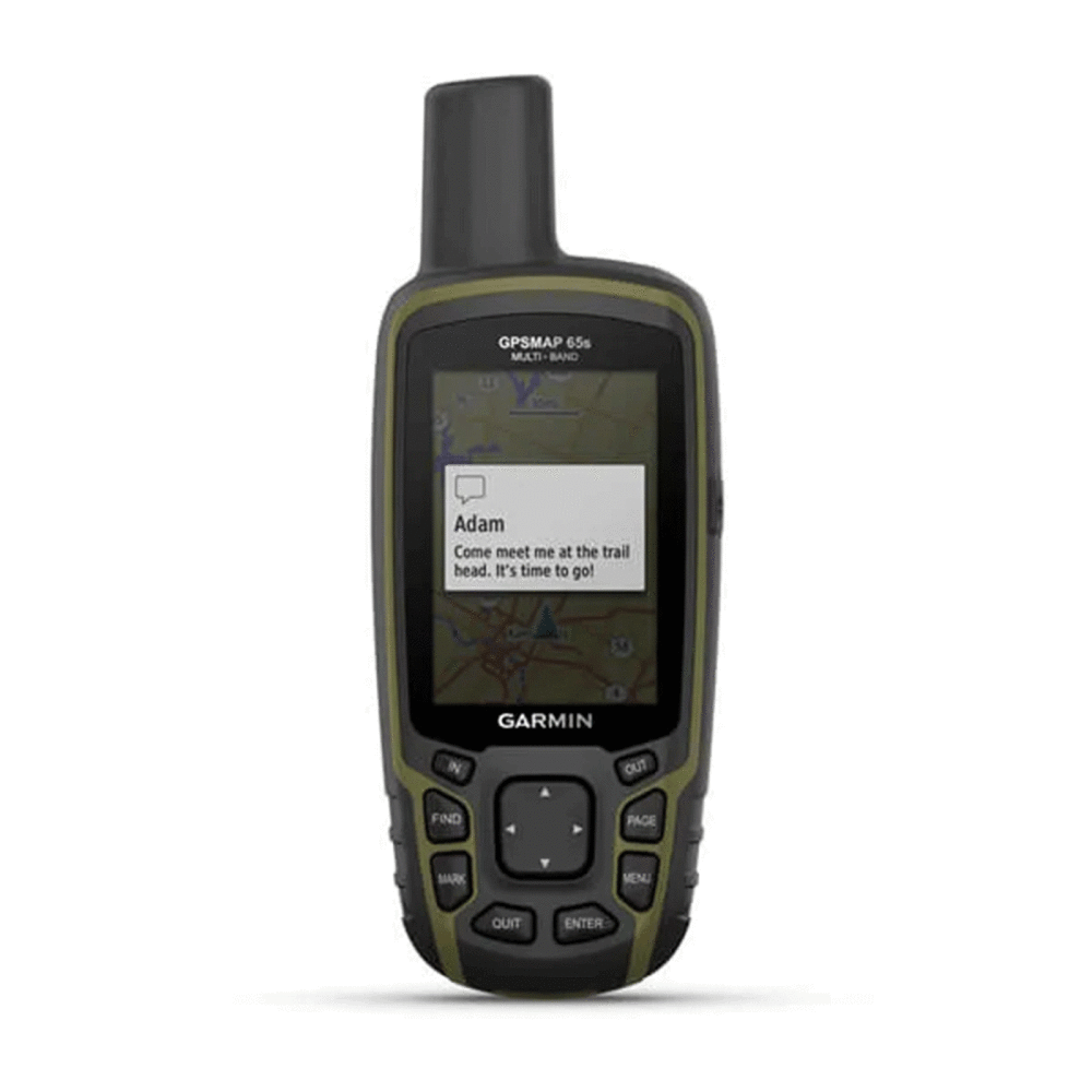
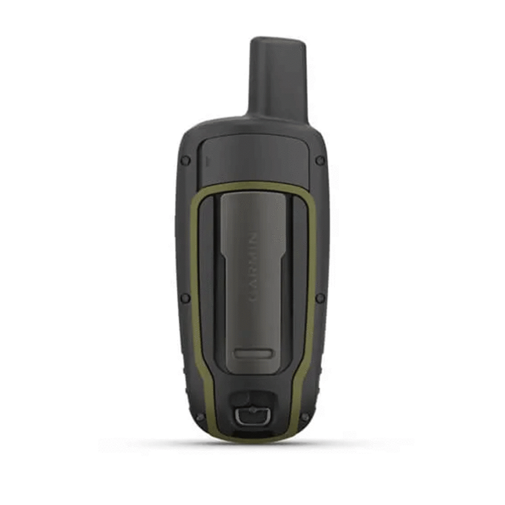
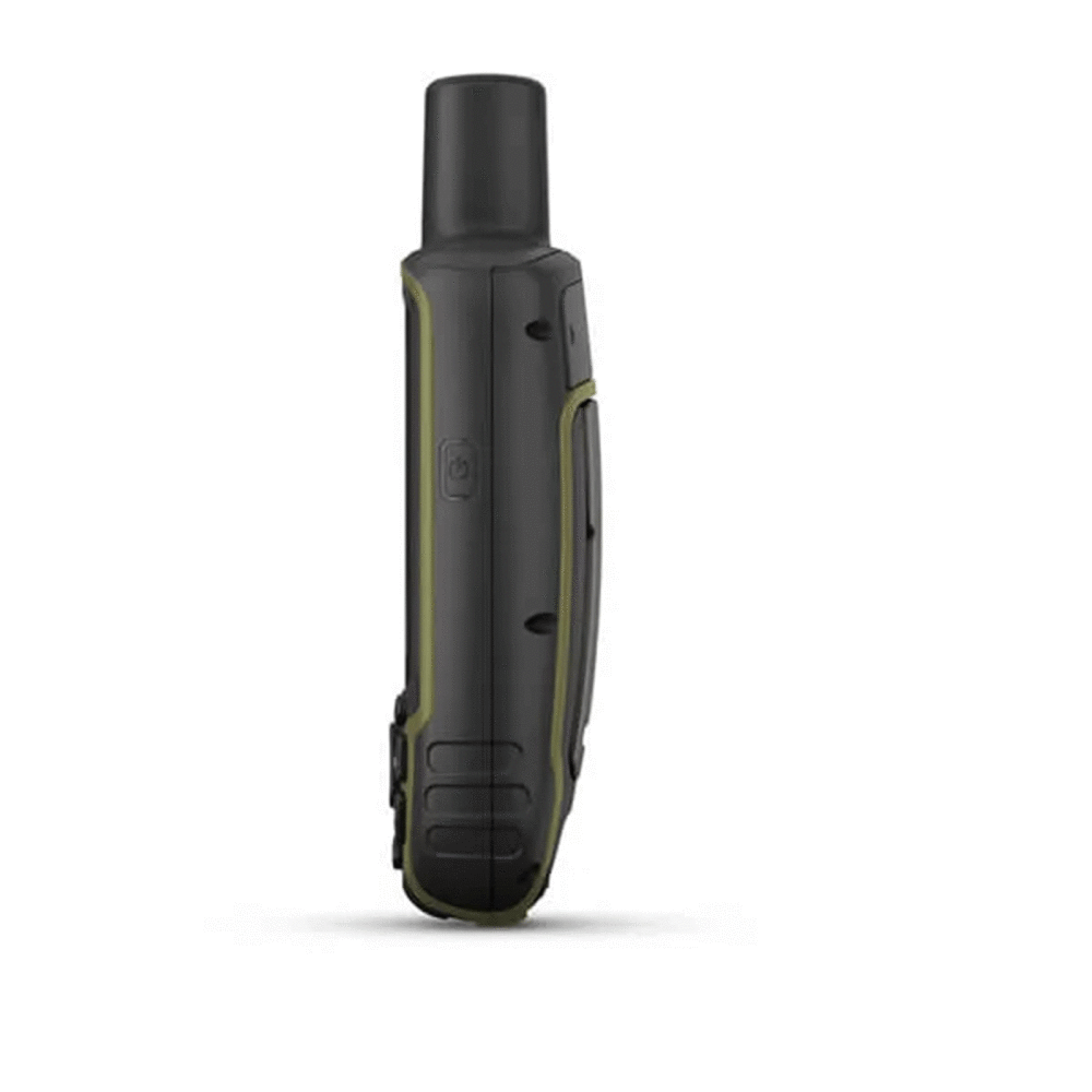
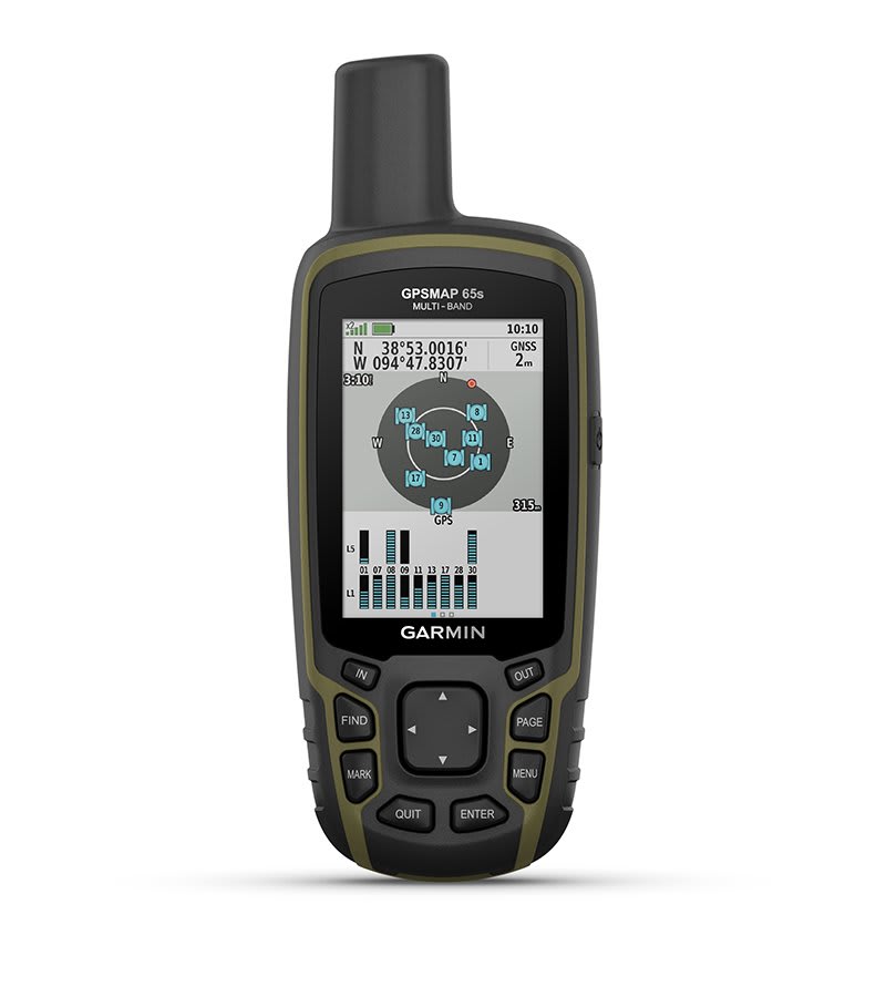
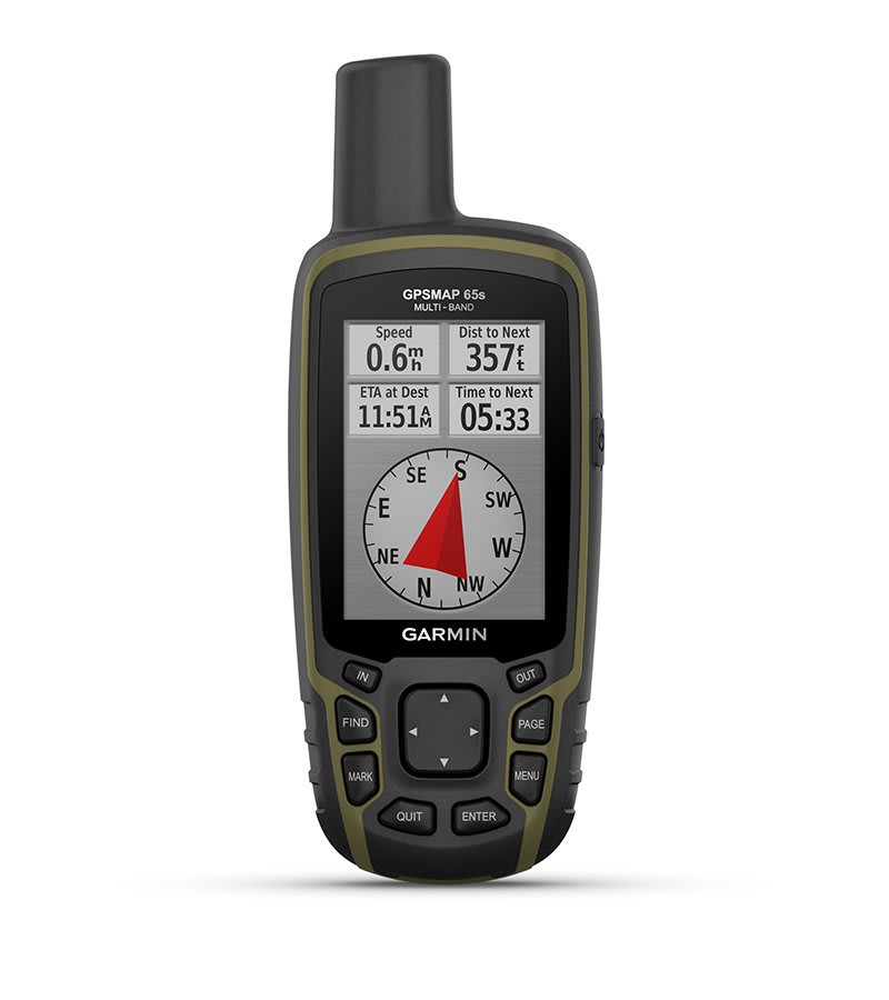
Description
Description
https://youtu.be/0c4mEtaMlhc
- LENS MATERIAL chemically strengthened glass
- DIMENSIONS 6.1 x 16.0 x 3.6 cm
- WEIGHT 217 g with batteries
- IPX7 WATERPROOF RATING
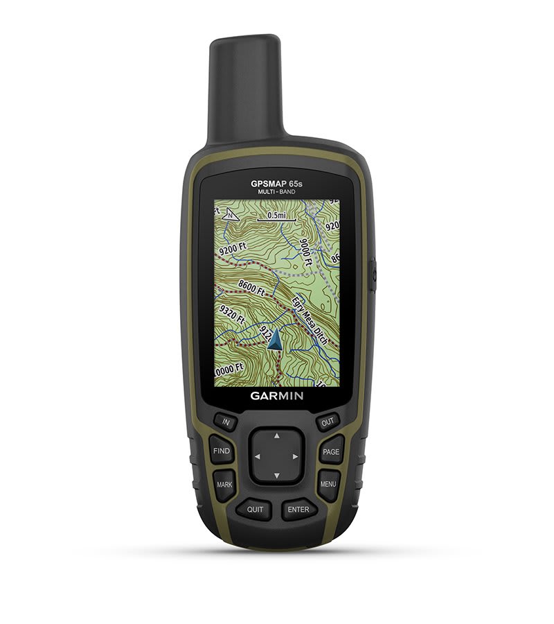
- SCREEN TYPE 65k transflective color TFT touchscreen
- SCREEN DIMENSIONS, WXH 3.6 x 5.5 cm; 2.6 inches diagonally (6.6 cm)
- SCREEN RESOLUTION, WXH 160 x 240 pixels
- BATTERY 2 AA batteries (not included); NiMH or lithium recommended
- BATTERY LIFE 16 hours
- MEMORY/HISTORY 16 GB (user space varies based on maps included)
- INTERFACE Compatible with NMEA 0183 and mini USB high speed
- PRELOADED MAPS Yes (TopoActive Europe; navigable)
- ADDITIONAL MAPS
- WORLD BASEMAP
- AUTOMATIC ROUTE CALCULATION (WITH PRECISE TURN INDICATIONS)
- SEGMENTS MAP 3
- BIRDSEYE 250 BirdsEye satellite image files
- INCLUDES DETAILED HYDROGRAPHIC INFORMATION (COASTLINES, RIVER/LAKE BANKS, MARSHES AND PERENNIAL AND SEASONAL WATERWAYS)
- INCLUDES SEARCHABLE POINTS OF INTEREST (PARKS, CAMPSITES, VIEWPOINTS AND PICNIC AREAS)
- ALLOWS YOU TO VIEW NATIONAL, STATE AND LOCAL PARKS, FORESTS AND NATURE RESERVES
- STORAGE AND POWER CAPACITY Yes (32GB max microSD™ card)
- MEMORIZABLE POSITIONS 5
- TRACKS 200
- TRACK LOG 10,000 points, 200 saved tracks
- MEMORIZABLE ROUTES 200, 250 points per route; automatic route calculation 50 points
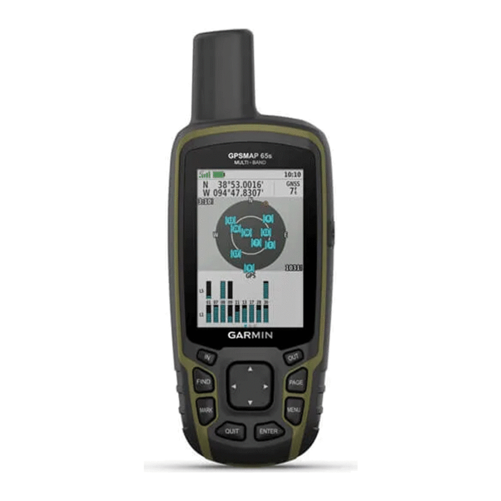
- GPS
- GLONASS
- GALILEO
- QZSS
- BAROMETRIC ALTIMETER
- COMPASS Yes (with tilt compensation, 3-axis)
- HIGH SENSITIVITY GPS RECEIVER
- GPS COMPASS (MOVING)
- MULTIBAND FREQUENCY
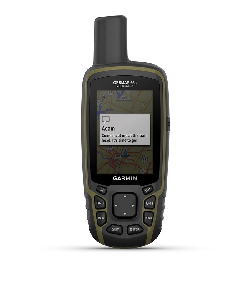
- SMART NOTIFICATION ON YOUR PORTABLE DEVICE
- VIRB™ REMOTE CONTROL
- COMPATIBLE WITH GARMIN CONNECT™ MOBILE
- POINT TO POINT NAVIGATION
- AREA CALCULATION
- FISHING FORECAST
- EPHEMERIDS
- SUITABLE FOR GEOCACHING Yes (computerised)
- CUSTOM MAPS COMPATIBLE Yes (500 custom map tiles)
- IMAGE VIEWER
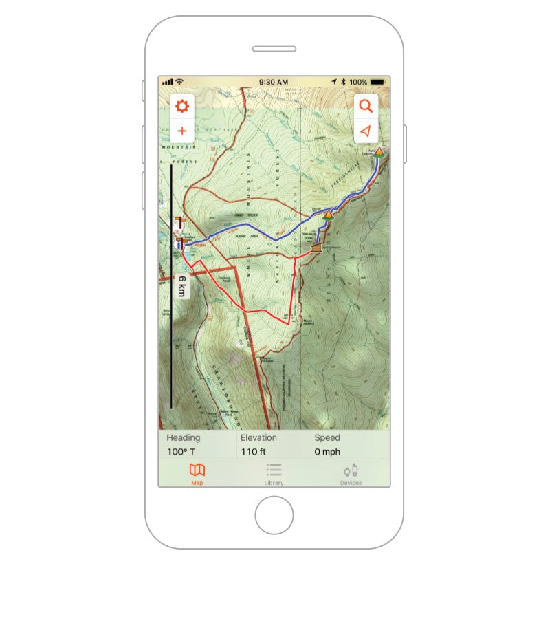
- COMPATIBLE WITH THE GARMIN EXPLORE™ APP
- COMPATIBLE WITH THE GARMIN EXPLORE WEBSITE
- WIRELESS CONNECTIVITY Yes - Bluetooth®, ANT+®
- SECURITY UPDATES UNTIL AT LEAST (YYYY-MM-DD) 2022-09-08
- GPSMAP 65s
- USB cable
- Carabiner for belt
- Documentation
Secure and certified payments
Your payment details are processed securely. We use the best payment systems on the market.
Pay in 3 installments with:

Pay your order in 3 monthly installments. No interest.